English: Pennine Way beside Malham Tarn The Na...

English: Pennine Way beside Malham Tarn The National Trail passes on the east side of Malham Tarn – itself an oddity in porous limestone country. Silurian slate pushed up by the Craven Fault ensures that the lake sits on an impervious bed of rock and thus does not drain away. (Photo credit: Wikipedia)

Malham Cove near Malham in the Yorkshire Dales...

Malham Cove near Malham in the Yorkshire Dales, United Kingdom (Photo credit: Wikipedia)

Here we are in very familiar territory, from Broughton to Gargrave to Airton, Kirkby Malham, and Malham.

Week 6 in the real world was 15 miles, some on the seawall, some on Mayne on the loop through the meadow and Village Bay.

Won’t describe in detail the Vancouver/Mayne weather which fluctuates between marvellous and wonderful.

This stretch of countryside is very special to Jenny and I, as we have stayed near the Pennine Way, three times in the last five years. We have been over for a myriad of activities, for weddings, funerals, fundraiser balls, pilgrimages, placing parents ashes, 50th reunions, Butcher Guild dinners, and visits with family and friends. We usually stay sort of midway between relatives and friends in Lancashire and Yorkshire, at Town End Farm, Airton, (about 100 yards from the Pennine Way) with a wonderful view of Malham Cove, superb accommodation, friendly hosts and a wonderful Farm Shop.

Malham Cove

English: The Pennine Way and Malham Beck The P...

English: The Pennine Way and Malham Beck The Pennine Way as it leaves Malham alongside Malham Beck. (Photo credit: Wikipedia)

Malham Cove

Malham Cove (Photo credit: Jon Pinder)

Malham Cove reveals the Middle Craven Fault

Malham Cove reveals the Middle Craven Fault (Photo credit: Wikipedia)

English: The Climb to Top Withens. Thought to ...

English: The Climb to Top Withens. Thought to be the inspiration for the Earnshaws home in Emily Brontes’ novel ‘Wuthering Heights’. (Photo credit: Wikipedia)

English: Top Withens, said to have been the in...

English: Top Withens, said to have been the inspiration for Wuthering Heights (Photo credit: Wikipedia)

English: Pennine Way, Dick Delf Hill. Heading ...

English: Pennine Way, Dick Delf Hill. Heading towards Top Withins (centre), the putative inspiration for Emily Brontë’s Wuthering Heights, on the Pennine Way. View northwards from the northeastern corner of the square. (Photo credit: Wikipedia)

A delightful week in Canada, sea wall walking excellent, then over to Mayne Island, and walking the meadow and ferry road loop. Rained most days, but showery. On the virtual walk, started in the  heart of Bronte country, not where Emily Bronte lived but where Wuthering Heights

Wuthering Heights (1998 film)

Wuthering Heights (1998 film) (Photo credit: Wikipedia)

was set, at High Withins. Jenny and I were there last October, we did a side trip through the area, rather than going Malham/Airton to Ramsbottom via the Ribble valley. It was quite bleak (but no more so than many of the moors in this neck of the woods), and on that note I should confess, last week I was virtually walking on the moors closest to my home town of Ramsbottom, and failed to note it. What an omission). From High Withins, the trail dropped down to Ickornshaw (the Black Bull),

Approaching Ickornshaw

Approaching Ickornshaw (Photo credit: Bods)

then on to Cowling and Lotharsdale, a lower valley, with some haying. Weeks trail ended  a few miles north, on the trail to Gargrave, near the Colne  to Skipton A56 and Garstang to Skipton A59, both very familiar roads.

Skipton Canal

Skipton Canal (Photo credit: Mill View)

Mankinholes sheep

Mankinholes sheep (Photo credit: Tim Green aka atoach)

English: High Moss. The road at the bottom of ...

English: High Moss. The road at the bottom of the photograph is the M62 Motorway (Photo credit: Wikipedia)

Colne Valley towards Huddersfield

Colne Valley towards Huddersfield (Photo credit: urbanmkr)

Black Moss

Black Moss (Photo credit: Bods)

English: Pennine Bridleway, Longden End Valley...

English: Pennine Bridleway, Longden End Valley Mountain biker climbing out of the valley of Longden End Brook on the Pennine Bridleway National Trail. The M62 motorway is in the middle distance. (Photo credit: Wikipedia)

The M62 passes Scammonden Reservoir in West Yo...

The M62 passes Scammonden Reservoir in West Yorkshire. (Photo credit: Wikipedia)

Black Moss

Black Moss (Photo credit: Bods)

A little behind last week, over on Mayne Island, with lots of visitors and lots of gourmet eating. “What we do well”, said one guest. managed to persuade some guests that riding the ride on mower could be fun, so managed most of the mowing. The grass was looooong. Mixed weather, some cloudy periods, some showers. Toward end of week 4, brightened, and much warmer, in time for dragon Boat races in false Creek, and Jazz festival downtown. So lots of seawall walking this week, and a few more hills per instructions from cardio.

O

Colne Valley

Colne Valley (Photo credit: Arctic–Fox)

Bronte Country

Bronte Country (Photo credit: J.harwood)n the Pennine Way, started out near Black Moss, Black Hill, soon afterwards dropping down into the Colne Valley, with several road connections, Oldham to Leeds, Holmefirth Moss (childhood memories, where our TV signal came from (and some nights, mysteriously, no signal, usually when we had lost of homework).  later crossed the Manchester to Leeds roads, and the M62 motorway and dropping down to the Rochdale to Halifax Road. This is where I remember the long weekend Venturer scout hike (1960??) with friends Brian and Doug, from Littleborough I think, over the tops to Mankinholes, Stoodly Pike  and Todmorden. Bleak. and on to Hebden Bridge, Top Withins Wuthering Heights and Bronte country. Even bleaker. Some of the route and sights.n the Pennine Way, started out near Black Moss, Black Hill, soon afterwards dropping down into the Colne Valley, with several road connections, Oldham to Leeds, Holmefirth Moss (childhood memories, where our TV signal came from (and some nights, mysteriously, no signal, usually when we had lost of homework).  later crossed the Manchester to Leeds roads, and the M62 motorway and dropping down to the Rochdale to Halifax Road. This is where I remember the long weekend Venturer scout hike (1960??) with friends Brian and Doug, from Littleborough I think, over the tops to Mankinholes, Stoodly Pike  and Todmorden. Bleak. and on to Hebden Bridge, Top Withins Wuthering Heights and Bronte country. Even bleaker. Some of the route and sights.

n the Pennine Way, started out near Black Moss, Black Hill, soon afterwards dropping down into the Colne Valley, with several road connections, Oldham to Leeds, Holmefirth Moss (childhood memories, where our TV signal came from (and some nights, mysteriously, no signal, usually when we had lost of homework).  later crossed the Manchester to Leeds roads, and the M62 motorway and dropping down to the Rochdale to Halifax Road. This is where I remember the long weekend Venturer scout hike (1960??) with friends Brian and Doug, from Littleborough I think, over the tops to Mankinholes, Stoodly Pike  and Todmorden. Bleak. and on to Hebden Bridge, Top Withins Wuthering Heights and Bronte country. Even bleaker. Some of the route and sights.

Weather for week 2, in Vancouver, generally sunny, one or two showers, 18C-22C.Weather in the Peak District, I missed most of the daily forecasts, have yet to find a good retro site, but the long range forecast was for cooler and cloudy to begin the week, strong possibilities of showers, worsening by weekend.

A good week of progress, managed 15.5 miles for the week, building toward the end with a Saturday seawall walk from Moberly (Monk McQueen’s) to Granville Island and back.

In the Peak District, skirted the western slopes of Kinder Scout, and Kinder Edge, so walking on familiar hard Millstone Grit and sandstones which give the rugged edges and cliffs.                    Untitled   wsesttrail on moor edge

Later, dropped from the scarp, and headed across Featherbed Moss. Some trail building here, to protect the delicate peat moss moorlands.

looking back to Kinder edgeuntamed bog bog walk


Cross the Snake Pass A57 Manchester to Sheffield, and head toward Bleaklow, then down to Torside and Crowden


sheep civilization, Crowder


Back up to the moors

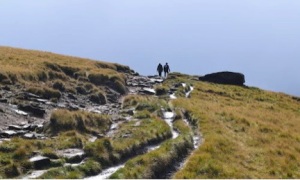
hikers near crowden? clouds gathering


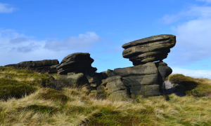
And on to Black TorBlack hill Laddow Rocks Bareholm Moss ; Black Tor

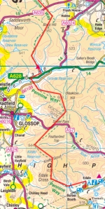
Pennine-Way-1-map1

This blog tracks my progress on a “virtual” hike of the Pennine Way. Virtual because I live in Vancouver, and transporting my mind and surgery recovery regime goals to a real life hike I have long admired seems like a good idea.

I have just completed open heart surgery, quadruple arterial bypass, and am starting into a walking regime for recovery. Walking as exercise is not strange to me, I live adjacent the Vancouver seawall, and walk it regularly. The seawall path is an amazing and pleasant LEVEL place to hike, run, bike, etc; to meet interesting people from all over the world, watch dogs and kids playing, dragon boats and scullers training in in False Creek, the City buildings, the North Shore Mountains and constantly changing views. 

And it rains a lot here, and so on heavy rain days I walk the apartment hallways. The only relief from boredom is the changing door numbers.

So I decided to do a virtual hike of the Pennine Way.

Parts of the Pennine Way are not unfamiliar, I was born and bred next to the moorlands at Ramsbottom, and hiked and walked on the moors regularly. I have childhood memories of the peak District area, and am familiar with the mid Ribble valley (the Yorkshire part of Lancashire) and around Malham. Three times in recent years my wife and I have stayed at Airton, near Malham, and walked parts of the Pennine Way daily.

Progress will be slow. I am starting out at under a mile a day, and slowly building up. My intent is to record what is happening on my virtual journey, post photos from a variety of sources, interesting news items, maybe some posts from real life travellers. I may augment it with what I encounter on my real time walking. This my first ever blog, I am a 69 year old techno dwarf, so bear with me as I set out on this learning curve and healing journey.

Hope Valley, Derbyshire

Hope Valley, Derbyshire (Photo credit: Lionel1939)

English: Grindsbrook Clough. A deep clough pen...

English: Grindsbrook Clough. A deep clough penetrates the high plateau of Kinder Scout above Edale. (Photo credit: Wikipedia)

Week One. Weather (from BBC) warmish, 19C, expected to cool down toward end of the week to 12/13C. Started in the village of Edale. I remember this vaguely from my pre-teen years walking in the Hope Valley, and have vague recollections of visiting the Edale Youth Hostel one weekend as a teenager in the late 1950’s. It being May 26, Trinity Sunday, appropriate that the Edale village church is Trinity Church.

My real life progress, in hospital, apartment hallways and False Creek Seawall, has been 7.7 miles this week. Weather rainy to start, improving later to 23C at the weekend, hundreds of people out on the seawall, walking jogging biking, blading, ambling, enjoying the sun, boats in the harbour. Life is good.

English: The Edale Village Church, Derbyshire

English: The Edale Village Church, Derbyshire (Photo credit: Wikipedia)

Not sure of the exact trail yet, maps still being sought, but a superimposition of National Park maps and Google show it skirting Kinder Scout on the west flank. Pics of the peak and surroundings follows.  Not sure of all my blogging techniques yet, have some other pics to add, but can’t intuitively find out how to do it in draft edit mode.

A healthy body is a guest chamber for the soul, a sick body a prison. Francis Bacon

Ironic, to be quoting Bacon, which is a banned substance for those striving to prevent or recovering from heart disease.